A River Runs Through It
|
Getting your Trinity Audio player ready...
|
A PUSH FOR GREATER ACCESS TO THE GABLES WATERWAY
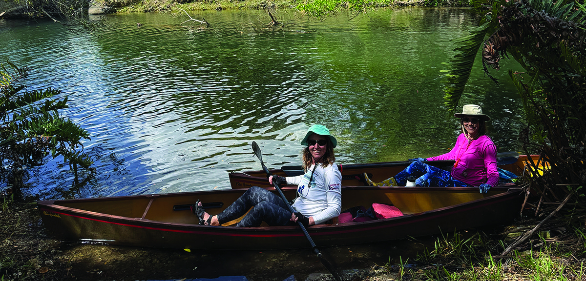
On a recent morning at Ruth Bryan Owen Park, two intrepid boaters struggled to maneuver their canoes down a sloped patch of grass toward the calm surface of the Gables Waterway. There was no dock, no launch ramp, and no clear access point – just a narrow gap between trees where paddlers have quietly slipped into the water for years. Scenes like this are not uncommon along the historic canal, where kayakers and canoers find places where they can slip their small craft into the water. Despite miles of waterfront and some of the city’s most scenic landscapes, there are surprisingly few places where residents can easily reach the Gables Waterway – unless they own a home on its banks or enter with a powerboat from Biscayne Bay. That could change. A growing effort led by local advocates and supported by city planners aims to create several official access points along the Gables Waterway, small projects that together could reshape how residents interact with one of the city’s most overlooked natural assets.
A WATERWAY HIDDEN IN PLAIN SIGHT
The Gables Waterway was carved during the early development of Coral Gables in the mid 1920s, as part of Merrick’s Mediterranean-inspired vision for the city, where nature would be part of the design rather than erased by it. Today it winds through neighborhoods, under bridges, and alongside parks, yet much of it remains physically and visually disconnected from the public. For longtime resident John Swain, the lack of access seems like a missed opportunity.
“If you want to launch a canoe or kayak, you basically have to improvise,” says Swain. “But once you’re on the canal, it’s beautiful. You can paddle through mangroves, see birds and other wildlife – it’s like a hidden nature corridor right in the middle of the city.”
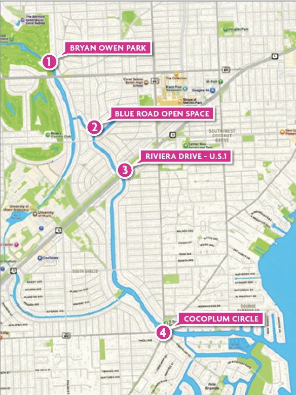
Swain, a former member of the city’s Waterway Advisory Board, has spent years advocating for small infrastructure changes that would allow residents to reach the canal more safely and easily. His proposals focus on four locations that could serve as gateways to the waterway system: Ruth Bryan Owen Park, Blue Road Open Space, Riviera Drive near U.S. 1, and the Cocoplum Circle area along LeJeune Road.
Among the proposed improvements, Ruth Bryan Owen Park may be the closest to becoming reality. Located along the waterway adjacent to Granada Boulevard, just north of Bird Road, the park already attracts residents for picnics, fishing, and quiet time along its boardwalk. Right now, you can slide a canoe or kayak into the water from there, but plans discussed with city officials would add a formal canoe launch along with amenities such as bike racks and water fountains.
The city’s capital improvement plan earmarks about $890,000 for park upgrades between 2026 and 2030, and while the plan does not explicitly mention such access, Swain says conversations with city officials indicate it is part of the proposal. Another key site is the Blue Road Open Space, recently redesignated as the David Lawrence Jr. and Family Park (see story pg. 20).
While the neighborhood park provides green space and recreation, some residents say it missed an opportunity to fully connect with the adjacent Waterway. Currently you can open a small gate and walk to the edge of the water, and even climb into a boat from there, but there is no way to lower a small watercraft. Advocates propose adding steps and docking facilities to allow access for canoes, kayaks, and paddleboards. “It’s a beautiful park,” says Swain. “But [as it is] it could have been anywhere. The waterway should be part of the experience.”
Another promising canoe launch site lies next to Riviera Drive as it crosses to U.S. 1, where a sloped ramp built during the Waterway’s construction has long served as an informal launch point. Paddlers still use the site today, despite parking restrictions and nearby construction. The location falls under Miami-Dade County jurisdiction, which has already designed a formal canoe launch for the area, though the project is not yet funded. If completed, it could connect directly to the Underline park network and become one of the most accessible entry points along the canal.
Perhaps the most ambitious proposal centers on Cocoplum Circle, where LeJeune Road crosses the Waterway. Right now, if you want to access the Waterway, you can park at one of a handful of spaces on the circle, climb over a fence, and waddle down a slope to the water’s edge. Advocates envision a boardwalk along the Waterway, tucked beneath the main bridge and an adjacent pedestrian bridge, with a stairway allowing residents and paddlers to safely descend. The concept has received unanimous recommendations from both the city’s Waterway Advisory Board and Transportation Advisory Board. “It’s really a two-part project,” Swain says. “One part is beautification. The other part is safe transportation.”
Together, these proposed improvements represent a shift in how the city approaches the Gables Waterway. Instead of treating it as background scenery, the city could begin to integrate the canal dug by Merrick into daily life – creating places where residents can paddle, walk, fish, or simply enjoy the view. “This is one of the most beautiful parts of Coral Gables,” says Swain. “People just need a way to get to it.”


